DocVinewood (talk | contribs) No edit summary |
(→Trivia) Tags: Visual edit apiedit |
||
| (30 intermediate revisions by 12 users not shown) | |||
| Line 1: | Line 1: | ||
| − | [[File: |
+ | [[File:Grand Senora Desert-GTAV.png|border|275px|right]] |
{{Quote|Unbearably hot by days and unbearably cold by night, the Grand Senora Desert is the kind of place that can switch from a wonder of natural beauty to a post-apocalyptic hellhole very quickly.|GTA V digital manual}} |
{{Quote|Unbearably hot by days and unbearably cold by night, the Grand Senora Desert is the kind of place that can switch from a wonder of natural beauty to a post-apocalyptic hellhole very quickly.|GTA V digital manual}} |
||
| Line 5: | Line 5: | ||
The '''Grand Senora Desert''' is a desert located in [[Blaine County]], [[San Andreas in HD Universe|San Andreas]]. The town of [[Sandy Shores]] is located in this desert. It is bordered by the [[Great Chaparral]] in the south and the [[Alamo Sea]] in the north. |
The '''Grand Senora Desert''' is a desert located in [[Blaine County]], [[San Andreas in HD Universe|San Andreas]]. The town of [[Sandy Shores]] is located in this desert. It is bordered by the [[Great Chaparral]] in the south and the [[Alamo Sea]] in the north. |
||
| − | The Desert has a few noticeable locations, |
+ | The Desert has a few noticeable locations, such as the [[Senora National Park|Grand Senora National Park]], [[Sandy Shores]] and the [[Alamo Sea]]. The wildlife consists of [[Coyote|coyotes]] and a few [[Birds|bird]] species such as [[hawk]]s. |
==Climate== |
==Climate== |
||
[[File:Gta_v_lightning.jpg|thumb|250px|A storm in the desert.]]The area has an arid or [[wp:Desert climate|desert climate]], with hot temperatures during most of the year. Weather tends to be very sunny at times, and visual heatwaves are shown occasionally. Sandstorms occur often, while rain and thunderstorms rarely occur, but when they do, the weather becomes rough and extreme. |
[[File:Gta_v_lightning.jpg|thumb|250px|A storm in the desert.]]The area has an arid or [[wp:Desert climate|desert climate]], with hot temperatures during most of the year. Weather tends to be very sunny at times, and visual heatwaves are shown occasionally. Sandstorms occur often, while rain and thunderstorms rarely occur, but when they do, the weather becomes rough and extreme. |
||
| − | Rain is scripted to happen in the mission [[Friends Reunited]], in which [[Trevor Philips]] travels to Stab City to destroy a number of trailers that are owned by [[The Lost MC]]. |
+ | Rain is scripted to happen in the mission [[Friends Reunited]], in which [[Trevor Philips]] travels to [[Stab City]] to destroy a number of trailers that are owned by [[The Lost MC]]. |
==Places of Interest== |
==Places of Interest== |
||
| + | *[[Lester's Safehouse]] |
||
*[[Rebel Radio Building]] |
*[[Rebel Radio Building]] |
||
*[[Sandy Shores Airfield]] |
*[[Sandy Shores Airfield]] |
||
| Line 21: | Line 22: | ||
*[[24/7]] |
*[[24/7]] |
||
*[[Checkout!]] |
*[[Checkout!]] |
||
| + | *Flywheels Garage |
||
| − | *[[ |
+ | *[[Harmony Fleeca]] |
*[[Los Santos Customs]] |
*[[Los Santos Customs]] |
||
*[[Scoops Liquor Barn]] |
*[[Scoops Liquor Barn]] |
||
*[[You Tool]] |
*[[You Tool]] |
||
| + | *[[Yucca Motel]] |
||
| + | |||
| + | ==Notable Residents== |
||
| + | *[[Mushroom Hank]] |
||
==Roads and Streets== |
==Roads and Streets== |
||
*[[Algonquin Boulevard]] |
*[[Algonquin Boulevard]] |
||
| − | *Baytree Canyon Road |
+ | *[[Baytree Canyon Road]] |
| + | *[[Cat Claw Avenue]] |
||
| − | *Cholla Road |
||
| − | * |
+ | *[[Cholla Road]] |
| + | *[[Mount Haan Road]] |
||
*[[Nowhere Road]] |
*[[Nowhere Road]] |
||
*[[Route 68]] |
*[[Route 68]] |
||
*[[Senora Freeway]] |
*[[Senora Freeway]] |
||
| − | *Smoke Tree Road |
+ | *[[Smoke Tree Road]] |
| + | |||
| ⚫ | |||
| ⚫ | |||
| ⚫ | |||
| ⚫ | |||
| + | grandsenoradesert.jpg|Trevor outrunning the police in the Grand Senora Desert |
||
| + | GrandSenoraDesert-GTAV-next.jpg|The desert on a cloudy day in the enhanced version. |
||
| ⚫ | |||
==Trivia== |
==Trivia== |
||
| + | [[File:Senoea.jpg|thumb|right|200px|The misspelled hiking path sign.]] |
||
*The name "Grand Señora" means "Big Lady" in Spanish, referring to the dimension of the desert. Its name is most likely a reference to the [[wp:Sonoran Desert|Sonoran Desert]]. It could also be based on the [[wp:Palm Desert|Palm Desert]], which is in closer proximity to the [[wp:Salton Sea|Salton Sea]]. |
*The name "Grand Señora" means "Big Lady" in Spanish, referring to the dimension of the desert. Its name is most likely a reference to the [[wp:Sonoran Desert|Sonoran Desert]]. It could also be based on the [[wp:Palm Desert|Palm Desert]], which is in closer proximity to the [[wp:Salton Sea|Salton Sea]]. |
||
*Despite being named as "Grand Senora", the desert area is not that large, only being arid lands around [[Sandy Shores]]. |
*Despite being named as "Grand Senora", the desert area is not that large, only being arid lands around [[Sandy Shores]]. |
||
| + | *In the [[Beta Releases|beta]] of [[Grand Theft Auto V|''Grand Theft Auto V'']], the Grand Senora Desert was much bigger. |
||
| + | *There are signs on hiking paths with the name of the desert incorrectly spelt, "SENOEA DESERT". This was likely a typo as "R" is next to "E" on a keyboard. |
||
| + | * The Grand Senora Desert could be based on the higher Mojave Desert areas in San Bernardino County and Los Angeles County since it has a high concentration of Joshua Trees. |
||
| + | * There is an oil field at the western end of the desert that resembles [[Octane Springs]] in [[Bone County]]. |
||
| + | [[ru:Гранд-Сенора]] |
||
| ⚫ | |||
| − | |||
| ⚫ | |||
| − | Tmes6.jpg|Grand Senora Desert landscape. |
||
| ⚫ | |||
| ⚫ | |||
| ⚫ | |||
[[Category:Locations]] |
[[Category:Locations]] |
||
[[Category:Locations in GTA V]] |
[[Category:Locations in GTA V]] |
||
Revision as of 20:47, 26 March 2015
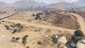
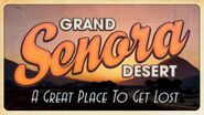
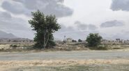
The Grand Senora Desert is a desert located in Blaine County, San Andreas. The town of Sandy Shores is located in this desert. It is bordered by the Great Chaparral in the south and the Alamo Sea in the north.
The Desert has a few noticeable locations, such as the Grand Senora National Park, Sandy Shores and the Alamo Sea. The wildlife consists of coyotes and a few bird species such as hawks.
Climate
A storm in the desert.
The area has an arid or desert climate, with hot temperatures during most of the year. Weather tends to be very sunny at times, and visual heatwaves are shown occasionally. Sandstorms occur often, while rain and thunderstorms rarely occur, but when they do, the weather becomes rough and extreme.
Rain is scripted to happen in the mission Friends Reunited, in which Trevor Philips travels to Stab City to destroy a number of trailers that are owned by The Lost MC.
Places of Interest
- Lester's Safehouse
- Rebel Radio Building
- Sandy Shores Airfield
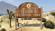
- Senora National Park
- Thomson Scrapyard
Businesses
- 24/7
- Checkout!
- Flywheels Garage
- Harmony Fleeca
- Los Santos Customs
- Scoops Liquor Barn
- You Tool
- Yucca Motel
Notable Residents
Roads and Streets
- Algonquin Boulevard
- Baytree Canyon Road
- Cat Claw Avenue
- Cholla Road
- Mount Haan Road
- Nowhere Road
- Route 68
- Senora Freeway
- Smoke Tree Road
Gallery
Trivia
The misspelled hiking path sign.
- The name "Grand Señora" means "Big Lady" in Spanish, referring to the dimension of the desert. Its name is most likely a reference to the Sonoran Desert. It could also be based on the Palm Desert, which is in closer proximity to the Salton Sea.
- Despite being named as "Grand Senora", the desert area is not that large, only being arid lands around Sandy Shores.
- In the beta of Grand Theft Auto V, the Grand Senora Desert was much bigger.
- There are signs on hiking paths with the name of the desert incorrectly spelt, "SENOEA DESERT". This was likely a typo as "R" is next to "E" on a keyboard.
- The Grand Senora Desert could be based on the higher Mojave Desert areas in San Bernardino County and Los Angeles County since it has a high concentration of Joshua Trees.
- There is an oil field at the western end of the desert that resembles Octane Springs in Bone County.
