Cloudkit01 (talk | contribs) No edit summary |
No edit summary Tag: sourceedit |
||
| (12 intermediate revisions by 6 users not shown) | |||
| Line 1: | Line 1: | ||
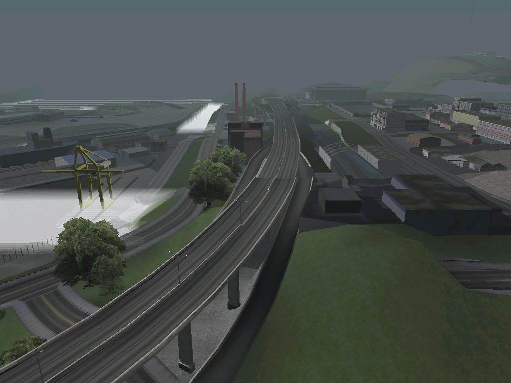
| + | [[File:SFBypass-GTASA-FromDowntown.jpg|thumb|220x220px|The San Fierro Bypass, seen from [[Downtown San Fierro|Downtown]].]] |
||
| − | [[File:LS_Bypass.jpg|thumb]] |
||
The '''San Fierro Bypass''' is a highway in [[Grand Theft Auto: San Andreas]]. |
The '''San Fierro Bypass''' is a highway in [[Grand Theft Auto: San Andreas]]. |
||
==Description== |
==Description== |
||
| − | + | Interstate 127, the San Fierro Bypass, runs from [[Whetstone]] to [[Tierra Robada]]. The Bypass is an elevated four lane bi-directional highway, with two lanes in each direction divided by a central reservation, which passes through the city of San Fierro before crossing the [[Garver Bridge]] and terminating at the [[Robada Intersection]] in southern Tierra Robada, with entry and exit junctions in various areas of San Fierro. Unlike the other highways in [[State of San Andreas (3D Universe)|San Andreas]], traffic on the San Fierro Bypass is generally slow-moving, except for the traffic crossing the Garver Bridge. |
|
| + | |||
| + | The Bypass appears to be based on [[wp:U.S. Route 101|U.S. Route 101]], whilst the section crossing the Garver Bridge appears to be based on [[wp:Interstate 80 in California|Interstate 80]]. |
||
| + | |||
| ⚫ | |||
==Exits and advisories== |
==Exits and advisories== |
||
| Line 17: | Line 21: | ||
|0.00 ft |
|0.00 ft |
||
|- |
|- |
||
| − | | |
+ | |1A |
|[[Foster Valley]]/[[Missionary Hill]] |
|[[Foster Valley]]/[[Missionary Hill]] |
||
|Parclo Intersection |
|Parclo Intersection |
||
|580.55 ft |
|580.55 ft |
||
|- |
|- |
||
| − | | |
+ | |1B |
| − | |[[Easter Bay International Airport|Easter Bay |
+ | |[[Easter Bay International Airport|Easter Bay Int'l]]/[[Garcia]] |
| |
| |
||
|2399.40ft |
|2399.40ft |
||
|- |
|- |
||
| − | | |
+ | |1C |
|[[San Fierro Highway|Jct. San Fierro Highway]]/[[Doherty]] |
|[[San Fierro Highway|Jct. San Fierro Highway]]/[[Doherty]] |
||
| − | | |
+ | |"T" intersection |
|3009.66 ft |
|3009.66 ft |
||
|- |
|- |
||
| − | | |
+ | |2 |
|[[Easter Basin]]/[[Doherty]]/[[Financial]] |
|[[Easter Basin]]/[[Doherty]]/[[Financial]] |
||
| |
| |
||
| Line 47: | Line 51: | ||
| |
| |
||
|- |
|- |
||
| − | | |
+ | |3A-B |
|[[Robada Intersection]] - [[Tierra Robada]]/[[Bone County]]/[[Las Venturas Highway|Jct. Las Venturas Highway]] |
|[[Robada Intersection]] - [[Tierra Robada]]/[[Bone County]]/[[Las Venturas Highway|Jct. Las Venturas Highway]] |
||
|"T" intersection |
|"T" intersection |
||
|14726.81ft |
|14726.81ft |
||
|- |
|- |
||
| − | | |
+ | |3A |
| − | |[[Las Venturas Highway|Jct. Las Venturas Highway East]] - [[Fort Carson]]/[[Bone County]]/[[Red County]]/[[Las Venturas]] |
+ | |[[Las Venturas Highway|Jct. Las Venturas Highway East]] - [[Fort Carson]]/[[Bone County]]/[[Red County]]/[[Las Venturas (3D Universe)|Las Venturas]] |
| |
| |
||
|14726.81 ft |
|14726.81 ft |
||
|- |
|- |
||
| − | | |
+ | |3B |
|[[Las Venturas Highway|Jct. Las Venturas Highway West]] - [[Tierra Robada]]/[[Bayside]]/[[Gant Bridge]] |
|[[Las Venturas Highway|Jct. Las Venturas Highway West]] - [[Tierra Robada]]/[[Bayside]]/[[Gant Bridge]] |
||
| |
| |
||
| Line 63: | Line 67: | ||
|} |
|} |
||
Exits are measured from the junction at a road leading to [[Flint County]] (Eastbound) and [[Missionary Hill]] (Westbound) |
Exits are measured from the junction at a road leading to [[Flint County]] (Eastbound) and [[Missionary Hill]] (Westbound) |
||
| − | |||
| − | ==Trivia== |
||
| ⚫ | |||
[[Category:Highways]] |
[[Category:Highways]] |
||
| + | [[Category:Pages with unsourced statements]] |
||
Revision as of 22:55, 17 May 2015
The San Fierro Bypass, seen from Downtown.
The San Fierro Bypass is a highway in Grand Theft Auto: San Andreas.
Description
Interstate 127, the San Fierro Bypass, runs from Whetstone to Tierra Robada. The Bypass is an elevated four lane bi-directional highway, with two lanes in each direction divided by a central reservation, which passes through the city of San Fierro before crossing the Garver Bridge and terminating at the Robada Intersection in southern Tierra Robada, with entry and exit junctions in various areas of San Fierro. Unlike the other highways in San Andreas, traffic on the San Fierro Bypass is generally slow-moving, except for the traffic crossing the Garver Bridge.
The Bypass appears to be based on U.S. Route 101, whilst the section crossing the Garver Bridge appears to be based on Interstate 80.
Including the Garver Bridge, the highway has a total length of 1.87 miles (3 kilometres).[citation/verification needed]
Exits and advisories
| Exit no. | Destination | Remarks | Post Mileage |
| DRIVE SLOWLY AT THIS POINT | 0.00 ft | ||
| 1A | Foster Valley/Missionary Hill | Parclo Intersection | 580.55 ft |
| 1B | Easter Bay Int'l/Garcia | 2399.40ft | |
| 1C | Jct. San Fierro Highway/Doherty | "T" intersection | 3009.66 ft |
| 2 | Easter Basin/Doherty/Financial | 5203.46 ft | |
| Garver Bridge Approach | 8177.22 ft | ||
| TRAFFIC TRAVELS AT FULL SPEED ON SUSPENSION BRIDGE. DRIVE SLOWLY ONCE AGAIN AFTER REACHING THE END OF THE SUSPENSION BRIDGE. | |||
| 3A-B | Robada Intersection - Tierra Robada/Bone County/Jct. Las Venturas Highway | "T" intersection | 14726.81ft |
| 3A | Jct. Las Venturas Highway East - Fort Carson/Bone County/Red County/Las Venturas | 14726.81 ft | |
| 3B | Jct. Las Venturas Highway West - Tierra Robada/Bayside/Gant Bridge | 15374.96 ft |
Exits are measured from the junction at a road leading to Flint County (Eastbound) and Missionary Hill (Westbound)