Hi everyone, please help us by filling out this form!
We are determining how players best define and/or differentiate the terms "game modes", "missions" and "activities". This will be used to help us develop a clear and logical category tree to house articles related to this type of content.
''This page is about the fictional State of San Andreas. For the game, please see [[Grand Theft Auto: San Andreas]]. For the city in [[Grand Theft Auto 1|GTA 1]] see [[City of San Andreas]]''.
+
{{Disambiglink|This article is about the State of San Andreas in the [[3D Universe]].<br>For the city in the original [[Grand Theft Auto (1997 game)|Grand Theft Auto]], see [[San Andreas (2D Universe)]].<br>For the state as it appears in [[Grand Theft Auto V]], see [[State of San Andreas (HD Universe)]].<br>For other uses, see [[San Andreas]].}}
{{Quote|San Andreas is one of the country's most diverse visitor destinations, known for its huge size and incredible variety. Although justly celebrated for its 3 wildly different main cities each with its own style and attractions to offer — Los Santos with its celebrities and sprawling ghettos, San Fierro with its eclectic artist community, and Las Venturas with the glitz and glamour of casinos — it has so much more beyond that; such as mountains, ghost towns, dense forests and hot, dry deserts. Take time to visit the whole state and support local businesses.|''GTA San Andreas'' Manual}}
+
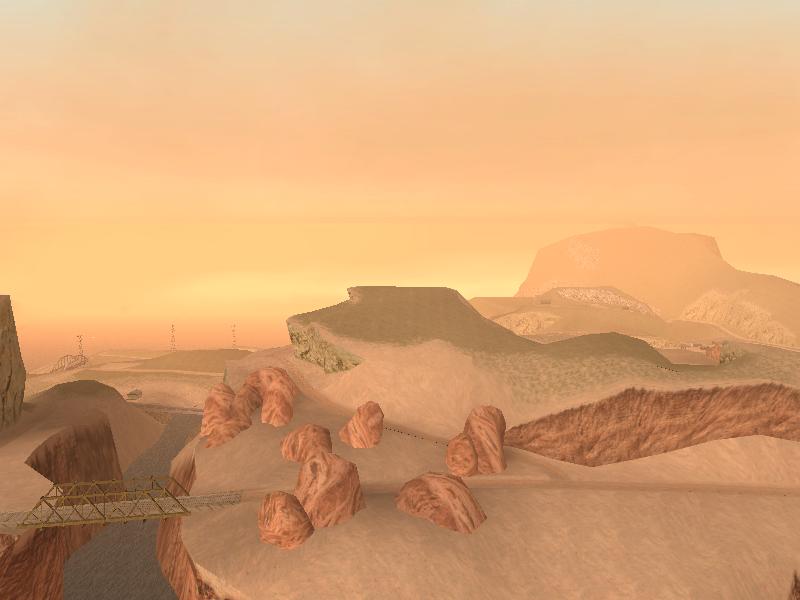
The '''State of San Andreas''' is a state in ''[[Grand Theft Auto: San Andreas]]''. It is primarily based on the states of {{WP|California}} and {{WP|Nevada}}, with some areas (particularly desert and forest areas) based on parts of {{WP|Arizona}}.
+
+
==Geography==
+
San Andreas appears to be comprised entirely of islands, as the state is surrounded by water; however, several maps throughout the state depict the northern regions ([[Tierra Robada]] and [[Bone County]]) connecting to the mainland (despite this, it is possible to completely circumnavigate the state by [[Boats|boat]]). The in-game San Andreas is square-shaped and its area is estimated to be 33 square kilometres in size (12.7 square miles), the largest setting in the ''[[Grand Theft Auto]]'' series up until ''[[Grand Theft Auto V]]''<nowiki/>'s rendition of part of the same [[State of San Andreas (HD Universe)|state]].
The state is divided into three cities and five counties: the cities of [[Los Santos (3D Universe)|Los Santos]], [[San Fierro (3D Universe)|San Fierro]] and [[Las Venturas (3D Universe)|Las Venturas]]; and the counties of [[Red County]], [[Flint County]], [[Whetstone]], [[Tierra Robada]] and [[Bone County]].
+
+
There are hints that more areas of San Andreas exist, but are simply not included for gameplay purposes. For example, some maps found in the game connect San Andreas to a mainland. There is also mention of an unnamed state capital.
[[File:Gtasa_areas.jpg|thumb|250px|High detail map of San Andreas showing city boundaries, [[Gang]] territories and certain buildings.]]
+
SanAndreasState-GTASA-OfficialRockstarHighResDownload.png|Official<ref>[https://www.rockstargames.com/newswire/article/47471/download-high-res-maps-for-gta-trilogy-titles.html Rockstar Games download]</ref> San Andreas Tourist Board high resolution map.
−
[[File:San_Andreas_Map.jpg|thumb|The street map of San Andreas]]
+
StateofSanAndreas-GTASA-StreetMap.png|Standard street map of San Andreas.
−
'''San Andreas''' is a fictional state in ''[[Grand Theft Auto: San Andreas]] and ''[[Grand Theft Auto V]]. ''It is mainly based on California and Nevada (only having the city Las Venturas based on Las Vegas and some desert region) while there are other notable areas and landmarks nodding to areas of Arizona (mainly the desert and forest areas). San Andreas appears to be comprised entirely of islands as the state is surrounded by water, however, several maps throughout the state depict the northern regions ([[Tierra Robada]] and [[Bone County]]) connecting to the mainland (despite this, however, in the game it's possible to completely circumnavigate the state by boat). San Andreas' area is estimated to be 36 square kilometers in size (13.9 square miles), the largest setting in the GTA series so far. The estimated population of the state is around 4-5 million making the population density of around 150,000 per square kilometer (350,000 per square mile), which would be the highest in the world. However, the area of the state would be the smallest if it were a real state in the U.S.
+
StateofSanAndreas-GTASAMobile-Map.jpg|Mobile version map of San Andreas. The map is slightly different than the original version.
+
SanAndreas-GTASAde-Map.jpg|Map of San Andreas in [[Grand Theft Auto: The Trilogy - The Definitive Edition|''Grand Theft Auto: San Andreas — The Definitive Edition'']].
+
GeoRegions-GTASA.png|Geographic regions of San Andreas.
StateofSanAndreas-GTASA-AreasMap.jpg|High detail map of San Andreas showing city boundaries, [[Gang]] territories and certain buildings.
+
TerritoriesNamesGTASA-map.png|Map showing the name of all sub-zones in ''Grand Theft Auto: San Andreas'', except for the sub-zone SAN_AND, which is the whole map.
The state is divided into three cities and five counties, the cities of [[Los Santos (3D Universe)|Los Santos]], [[San Fierro]] and [[Las Venturas]], and the counties of [[Red County]], [[Flint County]], [[Whetstone]], [[Tierra Robada]] and [[Bone County]].
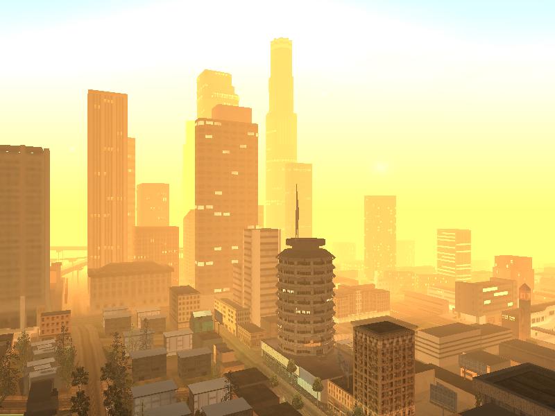
'''Los Santos''' is the largest city, both by population and area in San Andreas. It is [[File:LosSantosSunrise.jpg|thumb|250px|Los Santos]]based on Los Angeles, California. It is filled with references to famous L.A. landmarks, including the Hollywood Sign, the Watts Towers, the Capitol Tower, the U.S. Bank Tower and the Santa Monica Pier among many others. It borders Red County to the north and Flint County to the west. Los Santos also includes several fictional districts that resemble cities in L.A.County such as Santa Maria (Santa Monica), Rodeo (Beverly Hills), East Beach (Long Beach), [[Ganton]] (Compton), [[Idlewood]] (Inglewood) and [[Vinewood]] (Hollywood).
+
'''Los Santos''' is the largest city, both by population and area in San Andreas. It is based on {{WP|Los Angeles}}, {{WP|California}}. It is filled with references to famous L.A. landmarks, including the {{WP|Hollywood Sign}}, the {{WP|Watts Towers}}, the {{WP|Capitol Tower}}, the {{WP|U.S. Bank Tower}} and the {{WP|Santa Monica Pier}}, among many others. It borders [[Red County]] to the north and [[Flint County]] to the west. Los Santos also includes several districts that resemble cities in {{WP|Los Angeles County, California}}, such as [[Santa Maria]] ({{WP|Santa Monica, California|Santa Monica}}), [[Rodeo]] ({{WP|Beverly Hills, California|Beverly Hills}}), [[East Beach]] ({{WP|Long Beach, California|Long Beach}}), [[Ganton]] ({{WP|Compton, California|Compton}}), [[Idlewood]] ({{WP|Inglewood, California|Inglewood}}) and [[Vinewood]] ({{WP|Hollywood}}).
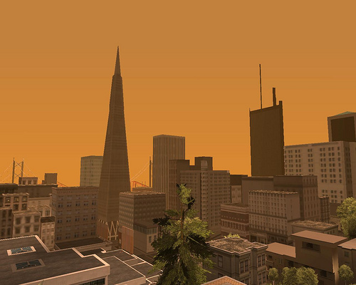
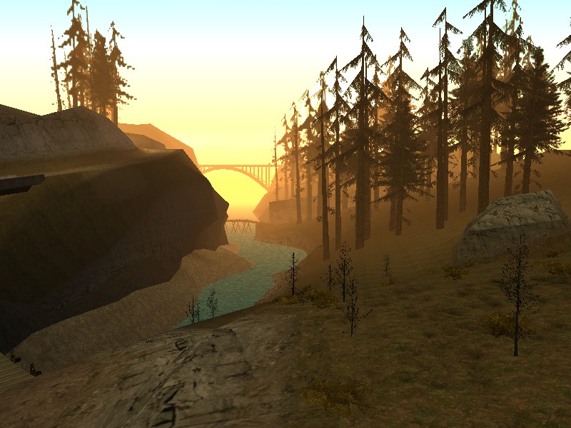
'''San Fierro''' is the smallest city in area and the second largest in population in San Andreas, situated on a peninsula in the western portion of the state. It is based on the city of San Francisco, California, with the additional references of two Firth of Forth bridges in Scotland, the Forth Bridge and the Forth Road Bridge, the latter being made to also resemble the San Francisco-Oakland Bay Bridge in both design and physical location. South of San Fierro lies the massive [[Mount Chiliad]] and the little town of [[Angel Pine]] in [[Whetstone]]. North of the city, across the [[Gant Bridge]] (San Fierro's version of the Golden Gate Bridge), lies the small town of [[Bayside]]. Northeast of the city lies the county of [[Tierra Robada]]. To the east is the [[Panopticon]], and to the southeast is [[Flint County]].
+
'''San Fierro''' is the smallest city in area and the second largest in population in San Andreas, situated on a peninsula in the western portion of the state. It is based on the city of {{WP|San Francisco}}, California, with the additional references of two {{WP|Firth of Forth}} bridges in {{WP|Scotland}}, the {{WP|Forth Bridge}} and the {{WP|Forth Road Bridge}}, the latter being made to also resemble the {{WP|San Francisco-Oakland Bay Bridge}} in both design and physical location. South of San Fierro lies the massive [[Mount Chiliad (3D Universe)|Mount Chiliad]] and the little town of [[Angel Pine]] in [[Whetstone]]. North of the city, across the [[Gant Bridge]] (San Fierro's version of the {{WP|Golden Gate Bridge}}), lays the small town of [[Bayside]]. Northeast of the city lies the county of [[Tierra Robada]]. To the east is the [[Panopticon]], and to the southeast is [[Flint County]].
−
The city bears visible scars of an earthquake, a likely reference to the [http://en.wikipedia.org/wiki/Loma_Prieta_Earthquake 1989 Loma Prieta earthquake], 3 years before the game takes place. However, news on the radio reports on the aftermath of an earthquake early in the game, suggesting that a major earthquake had hit the state recently.
+
The city bears visible scars of an earthquake, a likely reference to the {{WP|Loma Prieta Earthquake|1989 Loma Prieta earthquake}}, three years before the game takes place. However, news on the radio reports on the aftermath of an earthquake early in the game, suggesting that a major earthquake had hit the state recently.
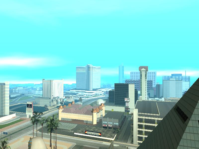
'''Las Venturas''' is a city based on {{WP|Las Vegas}}, {{WP|Nevada}}. It is the second largest city in area and smallest in population in San Andreas, and like its counterpart, Las Venturas is located in a desert region and hosts legalized gambling, sporting casinos such as [[The Camel's Toe]] and [[Caligula's Palace]].
'''Las Venturas''' is a fictitious city based on Las Vegas, Nevada. It is the second largest city in area and smallest in population in San Andreas, and like its counterpart, Las Venturas is located in a desert region and enjoys legalized gambling, sporting casinos such as ''[[The Camel's Toe]]'' and ''[[Caligula's Palace]]''.
−
The city is also notable for its freeway system. The [[Julius Thruway]] is a freeway that circles the whole city. Freeways from both Los Santos and San Fierro intersect with it. Another major road is the [[Harry Gold Parkway]], which runs through the middle of the city and intersects twice with the Julius Thruway and then leads to Los Santos (though it is not called the [[Harry Gold Parkway]] once it leaves the city). At one point in the game, the game's protagonist, Carl Johnson, pulls off an ''Ocean's 11''-esque heist in Caligula's Casino, subsequently fomenting relationships between Carl Johnson and [[Salvatore Leone]].
+
The city is also notable for its freeway system. The [[Julius Thruway]] is a freeway that circles the whole city. Freeways from both Los Santos and San Fierro intersect with it. Another major road is the [[Harry Gold Parkway]], which runs through the middle of the city and intersects twice with the Julius Thruway and then leads to Los Santos (though it is not called the Harry Gold Parkway once it leaves the city). At one point in the game, the game's protagonist, Carl Johnson, pulls off an {{WP|Ocean's Eleven}}-esque heist in Caligula's Casino, subsequently fomenting relationships between [[Carl Johnson]] and [[Salvatore Leone]].
Las Venturas is translated from Spanish to English as "The Fortunes."
Las Venturas is translated from Spanish to English as "The Fortunes."
−
==Counties and towns==
+
==Counties and Smaller Towns==
In addition to the three principal metropolises, San Andreas state is home to several smaller towns and suburbs that are scattered over several counties.
In addition to the three principal metropolises, San Andreas state is home to several smaller towns and suburbs that are scattered over several counties.
'''Red County''' is a rural county located among forests consisting of primarily tall redwood trees and streams. The county is based on the quintessential American countryside and is populated with stereotypical rednecks. It is based on the {{WP|Central Valley (California)|Central Valley}}, which is located in the center of California (the center of the map is in Blueberry Acres), the {{WP|San Fernando Valley}}, which is just north of Los Angeles, and {{WP|Orange County, California|Orange County}}, which is south of it.
'''Red County''' is a rural county located among forests consisting of primarily tall redwood trees and streams. The county is based on the quintessential American countryside and is populated with stereotypical rednecks. It is based on [http://en.wikipedia.org/wiki/San_Fernando_Valley San Fernando Valley], which is just north of [http://en.wikipedia.org/wiki/Los_Angeles Los Angeles], and also Orange County, which is south of it.
−
====The Panopticon====
====The Panopticon====
{{Main|The Panopticon}}
{{Main|The Panopticon}}
'''The Panopticon''' is a little area situated in [[Red County]].
'''The Panopticon''' is a little area situated in [[Red County]].
[[Image:Palomino.jpg|thumb|150px|right|Palomino Creek, with its infamous wheelchair on the dock.]]
−
'''Palomino Creek''' is a town located in north east Red County in the state of San Andreas. It is home to a bank, which has suffered from many robberies, a Pizza Stack, and Hanky Panky Point, a popular destination for teenage couples and weird old men. A mention on [[K-Rose]] radio station mentions a football game between Palomino Creek High School & Blueberry High School, in [[Blueberry]] (although there is neither a football field nor high school in either city).
+
'''Palomino Creek''' is a town located in north east Red County in the state of San Andreas. It is home to a bank, which has suffered from many robberies, a Pizza Stack, and [[Hanky Panky Point]], a popular destination for teenage couples and weird old men. [[K-Rose]] radio station mentions a football game between Palomino Creek High School and Blueberry High School in [[Blueberry]] (although there is neither a football field nor high school in either town), which might be a reference to the 1986 film {{WP|The Best of Times (1986 film)|The Best of Times}}, where Taft high school goes against Bakersfield high school in a football game, Bakersfield being a possible inspiration for Palomino Creek.
Palomino Creek is the largest settlement in the state outside of the major cities.
Palomino Creek is the largest settlement in the state outside of the major cities.
'''Montgomery''' is located in northeastern Red County. It has a small hospital called [[Crippen Memorial Hospital]], a [[Well Stacked Pizza]], and also contains a small [[Inside Track|horse betting shop]].
'''Montgomery''' is located in northeastern Red County. It has a small hospital,''Crippen Memorial'', a [[Well Stacked Pizza]], and also contains a small [[Inside Track|horse betting shop]].
'''Dillimore''' is located on the northern outskirts of Los Santos. Although it is a small town, it contains a [[Dillimore Police Station|sheriff's office]], a [[Pay 'n' Spray]], a [[Gasso|gas station]] and a [[The Welcome Pump|diner]]. It also has [[Dillimore Safehouse|a safehouse]] and houses the large farm estate which contains the [[Quad]].
'''Dillimore''' is located on the northern outskirts of Los Santos. Although it is a small town, it contains a sheriff's office, a [[Pay 'n' Spray]], a gas station and a [[The Welcome Pump|diner]]. It also houses the large farm estate which contains the [[Quad]].
'''Blueberry''' is the biggest rural town in Red County. On the outskirts of town, there is a [[Blueberry Acres|large farm]] and brewery. The town itself is home to a liquor store, [[Ammu-Nation]] and [[Blueberry Safehouse|safehouse]]. The climate resembles that of San Fierro. It is possible that the buildings on the outskirts of town are a high school, and the fields could possibly be a football field of some sort, which would answer an announcement on [[K-Rose]] about a football game between Blueberry & Palomino Creek.
'''Blueberry''' is the biggest rural town in Red County. On the outskirts of town, there is a large farm and brewery. The town itself is home to a liquor store and an [[Ammu-Nation]]. The climate resembles that of San Fierro. It is possible that the buildings on the outskirts of town are a high school, and the fields could possibly be a football field of some sort, which would answer an announcement on K-Rose about a football game between Blueberry & Palomino Creek.
'''Flint County''' is an undeveloped rural part of San Andreas. There are no towns and only a couple of farms. There are only a few missions in Flint County throughout the game which mostly involve racing through it.
'''Flint County''' is an undeveloped rural part of San Andreas. There are no towns and only a couple of farms. There are only a few missions in Flint County throughout the game which mostly involve racing through it.
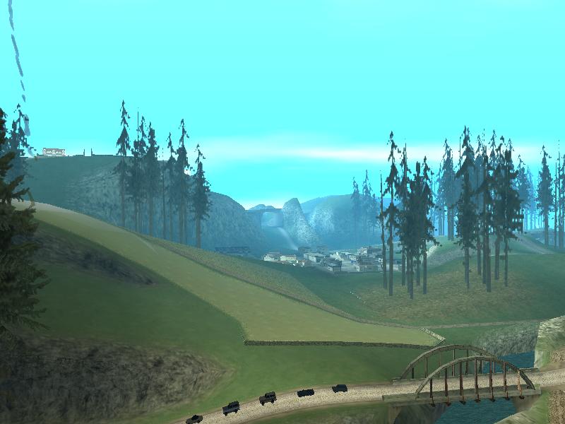
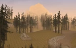
[[File:MountChiliad-GTASA-ViewFromShadyCreeks.jpg|thumb|150px|right|View of Whetstone featuring the most popular landmark of the area, [[Mount Chiliad (3D Universe)|Mount Chiliad]]]]
−
−
'''Whetstone''' is located in the south-west corner of San Andreas, just south of San Fierro. The county is home to Mount Chiliad, the tallest mountain in the state at a half-mile (800 m) in height.
+
'''Whetstone''' is located in the southwest corner of San Andreas, just south of San Fierro. The county is home to Mount Chiliad, the tallest mountain in the state at a half-mile (800 m) in height.
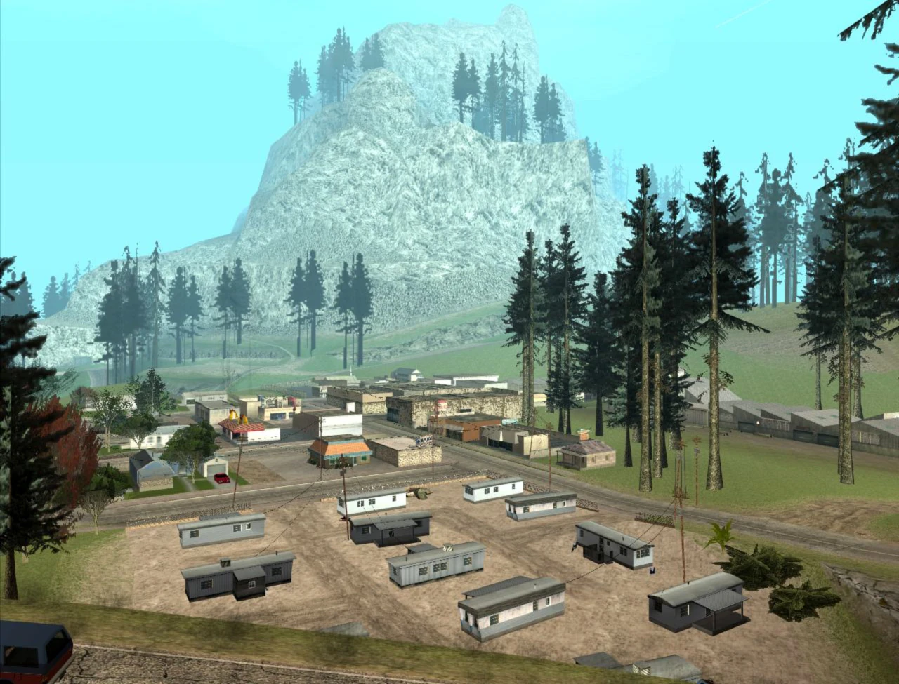
'''Angel Pine''' is a logging town in Whetstone, located on the foot of Mount Chiliad. It is notable because it contains a hospital from which [[Paramedic]] missions can be performed. It also contains a sheriff's office, a sawmill, an Ammu-Nation and a trailer park. Interestingly,a hearse may also be found parked near the hospital. [[Carl Johnson]] was dropped off here by [[Frank Tenpenny]], [[Eddie Pulaski]] and [[Jimmy Hernandez]] after [[Sweet Johnson]] was [[The Green Sabre|arrested]].
+
'''Angel Pine''' is a logging town in Whetstone, located on the foot of Mount Chiliad. It notably contains a hospital ([[Angel Pine Medical Center]]) from which [[Paramedic]] missions can be performed. It also contains a [[Angel Pine Sheriff Department|sheriff's office]], a [[Angel Pine Sawmill|sawmill]], an Ammu-Nation and a [[Angel Pine Mobile Home Park|trailer park]]. A [[Romero's Hearse|hearse]] may also be found parked near the hospital. [[Carl Johnson]] was dropped off here by [[Frank Tenpenny]], [[Eddie Pulaski]] and [[Jimmy Hernandez]] after [[Sweet Johnson]] was [[The Green Sabre|arrested]].
'''Bayside''' is a waterfront town located on the western tip of Tierra Robada, just north across the bay from San Fierro. The sole access point to the town is directly linked to San Fierro via the [[Gant Bridge]].
+
'''Bayside''' is a waterfront town located on the western tip of Tierra Robada, just north across the bay from San Fierro. The sole access point to the town is directly linked to San Fierro via the [[Gant Bridge]]. The town contains two notable features: First, its [[Boat School|boat school]], where Carl can obtain his boating licence; second, the town has a helipad, usually with a helicopter present, useful for traveling. It is a common rest stop for people traveling from San Fierro to Las Venturas.
−
−
The town contains two notable features. First, its [[Boat School|boat school]], where Carl can obtain his boating license. Second, the town has a helipad, usually with a helicopter present, useful for traveling. It is a common rest stop for people traveling from San Fierro to Las Venturas.
The presence of the [[Bayside Marina]] and its proximity to the Gant Bridge suggests that the town is primarily based on Sausalito, which is almost geographically similar to Bayside, in addition to having one of its access points connected directly to the Golden Gate Bridge.
The presence of the [[Bayside Marina]] and its proximity to the Gant Bridge suggests that the town is based on {{WP|Sausalito, California|Sausalito}}, California, and {{WP|Tiburon, California|Tiburon}}, California, before their upscale development, which is almost geographically similar to Bayside, in addition to having one of its access points connected directly to the Golden Gate Bridge.
'''El Quebrados''' is home to a [[El Quebrados Sheriff's Station|sheriff's department]], a medical centre ([[El Quebrados Medical Center]]), and a [[El Quebrados Safehouse|safehouse]]. The town is located east of Bayside. The name ''El Quebrados'', which is an improper mix of singular and plural Spanish, translates roughly to "The Bankrupt," or "The Broken".
'''El Quebrados''' is home to a sheriff's department, a medical center, and a safehouse. The town is located east of Bayside. The name ''El Quebrados'', which is an improper mix of singular and plural Spanish, translates roughly to "The Bankrupt," or "the Broken".
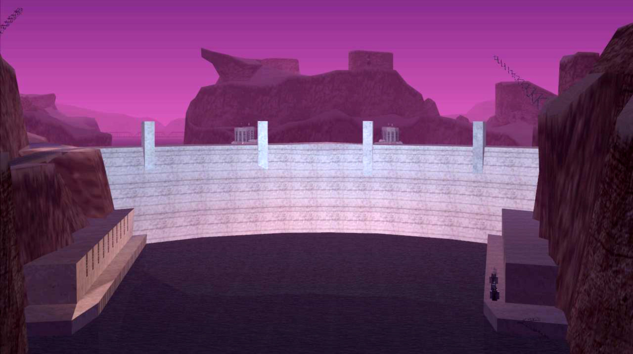
'''Las Barrancas''' is located within viewing range of the [[Sherman Dam]], and is also located just beside a cliffside ruin. "''Las Barrancas''" is Spanish for "Canyons". This town is likely based on {{WP|Moab, Utah|Moab}}, {{WP|Utah}}.
'''Las Barrancas''' is located within viewing range of the [[Sherman Dam]], and is also located just beside a cliffside ruin. "Las Barrancas" is Spanish for "Canyons".
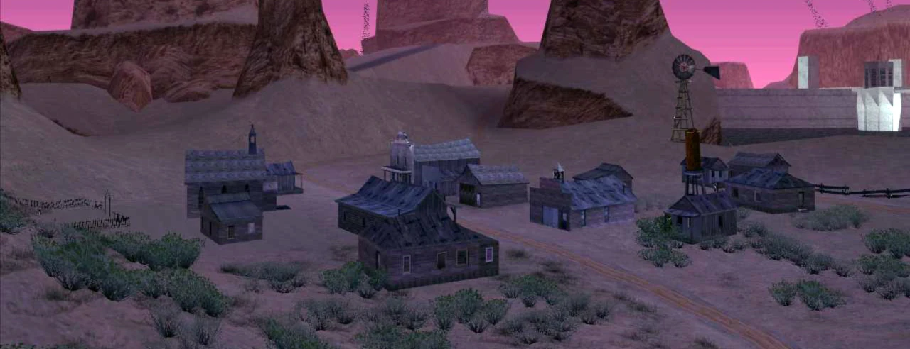
'''Aldea Malvada''' is a ghost town located in Tierra Robada overlooking El Quebrados on the outskirts of town. It literally translates into English as "Evil Village".
'''Aldea Malvada''' is a ghost town located in Tierra Robada overlooking El Quebrados on the outskirts of town. It literally translates into English as "Evil Village".
'''Bone County''', most likely based on {{WP|Nye County, Nevada|Nye}}, {{WP|Esmeralda County, Nevada|Esmeralda}}, and {{WP|Mineral County, Nevada|Mineral}} counties in Nevada, is one of the most important areas of the game, other than the major cities themselves, containing many areas and missions needed for continuation; a large amount of [[Secrets and Easter Eggs in GTA San Andreas|Easter Eggs]] are also located within it. The county's two most prominent features include a secret military base named "[[Area 69]]" (based on {{WP|Area 51}}) located at its centre, as well as the [[Verdant Meadows Airfield]], directly north of Area 69. Bone County boasts an oil field ([[Octane Springs]]), a [[Hunter Quarry|quarry]], and several unique natural features such as mesas.
'''Bone County, '''most likely based off Nye, Esmeralda , and Mineral counties in Nevada, is one of the most important areas of the game, other than the major cities themselves, containing many areas and missions needed for continuation; a large amount of eastereggs are also located within it. The county's two most prominent features include a secret military base named "[[Area 69]]" (based on Area 51) located at its center, as well as the [[Verdant Meadows]] Aircraft Graveyard, directly north of Area 69. Bone County boasts an oil field ([[Octane Springs]]), a [[Hunter Quarry|quarry]], and several unique natural features such as mesas.
The county is bordered in the west by the '''Sherman Reservoir''' and '''Sherman Dam''' (based on the Hoover Dam) as well as Tierra Robada county. Las Venturas is located to its east, and Red County to its south. The county as a whole is obviously based on rural portions for the American state of Nevada, because it has a similar climate, terrain and topography. A [[Dinghy]] raft and a [[Sea Sparrow]] can be found docked on both sides of the reservoir. Also, a [[Skimmer]] can be found just north of the dam, right at the part where the river (based on the {{WP|Colorado River}}) splits.
The county is bordered in the west by the '''Sherman Reservoir''' and '''Sherman Dam''' (based on the Hoover Dam) as well as Tierra Robada county. Las Venturas is located to its east, and Red County to its south. The county as a whole is obviously based on rural portions for the American state of Nevada, because it has a similar climate, terrain and topography.
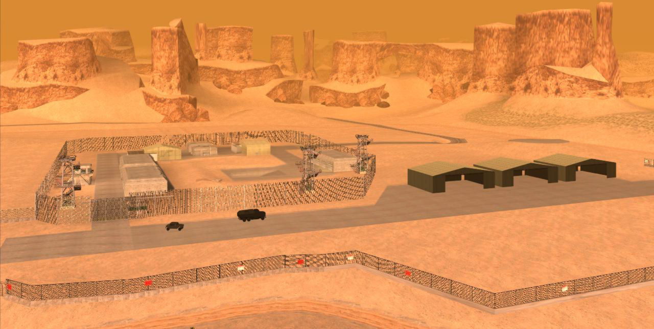
'''Area 69''' is a restricted, fenced-in military base, patterned after Area 51 and named for the 69 sex position. The base houses various clandestine government projects, including the "[[Black Project]]" [[jetpack]]. It may possibly house some projects involving UFOs and/or extraterrestrial life, as suggested by the presence of the nearby "[[Lil' Probe Inn]]" (a reference to the Lil' Ale Inn), dialog on the base's PA system during the "Black Project" mission, and by dialog on [[Marvin Trill|Marvin Trill's]] in-game radio show.
+
'''Area 69''' is a restricted military base, modeled after Area 51 and named for the 69 sex position. The base houses various clandestine government projects, including the "[[Black Project]]" [[jetpack]]. It may possibly house some projects involving UFOs and/or extraterrestrial life, as suggested by the presence of the nearby "[[Lil' Probe Inn]]", dialogue on the base's PA system during the "Black Project" mission, and by dialogue on [[Marvin Trill]]'s in-game radio show.
Much of the base consists of underground research labs, although the player can only enter the labs during the course of one mission, or by finding a way into San Andreas' "[[Blue Hell]]", an area under the main terrain mesh, and finding the underground base there. The above-ground structures include a series of control towers, guard posts, and garages for military vehicles. These garages are the first area in the game in which tanks and military helicopters will automatically spawn. The player automatically receives a five-star wanted level for entering, attempting to enter, or flying over the base (at a low altitude); surface-to-air missiles will be fired at the player from the base if he attempts to fly over. The SAM sites which launch the missiles can be destroyed however, and if flying a [[Hydra]] aircraft, flaredecoys can be deployed to reduce the likelihood of being shot down.
Much of the base consists of underground research labs, although the player can only enter the labs during the course of one mission, or by finding a way into San Andreas' "[[Blue Hell]]", an area under the main terrain mesh, and finding the underground base there. The aboveground structures include a series of control towers, guard posts, and garages for military vehicles. These garages are the first area in the game in which tanks and military helicopters will automatically spawn. The player automatically receives a five-star wanted level for entering, attempting to enter, or flying over the base (at a low altitude); surface-to-air missiles will be fired at the player from the base if he attempts to fly over. The SAM sites which launch the missiles can be destroyed however, and if flying a [[Hydra]] aircraft, decoy flares can be deployed to reduce the likelihood of being shot down.
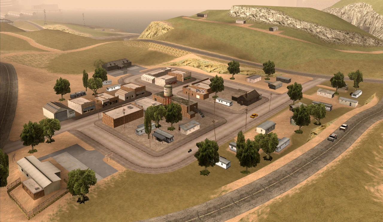
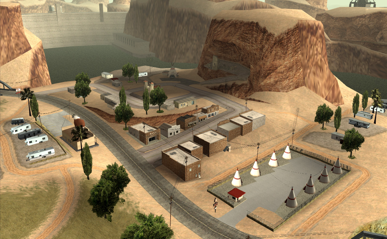
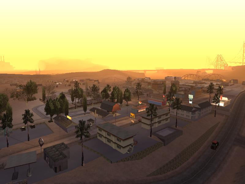
'''Fort Carson''' is the largest town in Bone County, and also its county seat, as indicated by the small red building in the main street, having been significantly undeveloped as of 1992. It is based on the reallife towns of Rachel and Carson City, both being in Nevada, Rachel is the closest habitation to Area 51, and houses the the Little A'le'inn. Carson City for the town itself; the main street, the town hall and the surroundings. North of the town is Area 69, as well as the smaller town of [[Las Payasadas]]. It has a small hospital and a sheriff's office. There is also an Ammu-Nation just outside of town. Fort Carson is also seen in "[[The Introduction]]". [[Ken Rosenberg]] was in rehab in the town's hospital. The town is located west of [[Las Venturas]]. A small [[Cropduster|cropduster]] is known to appear next to one of the houses near here and it is flyable.
'''Fort Carson''' is the largest town in Bone County, and also its county seat, as indicated by the small red building in the main street, having been significantly undeveloped as of [[1992]]. It is based on the real-life towns of [[WP:Rachel, Nevada|Rachel]] and [[WP:Carson City, Nevada|Carson City]], both being in Nevada: Rachel due to it being the closest inhabited settlement to Area 51 and housing the [[WP:|Little A'Le'Inn]]; Carson City for the appearance of the town itself; the main street, the town hall and the surroundings. North of the town is Area 69, as well as the smaller town of [[Las Payasadas]]. It also has a small hospital ([[Fort Carson Medical Center]]), a [[Fort Carson Sheriff's Station|sheriff's office]] and [[Fort Carson Safehouse|a safehouse]]. There is also an Ammu-Nation just outside of town. Fort Carson is also seen in "[[The Introduction]]". [[Ken Rosenberg]] was in rehab in the town's hospital. The town is located west of [[Las Venturas (3D Universe)|Las Venturas]]. A small [[Cropduster|cropduster]] is known to appear next to one of the houses near here and it is flyable.
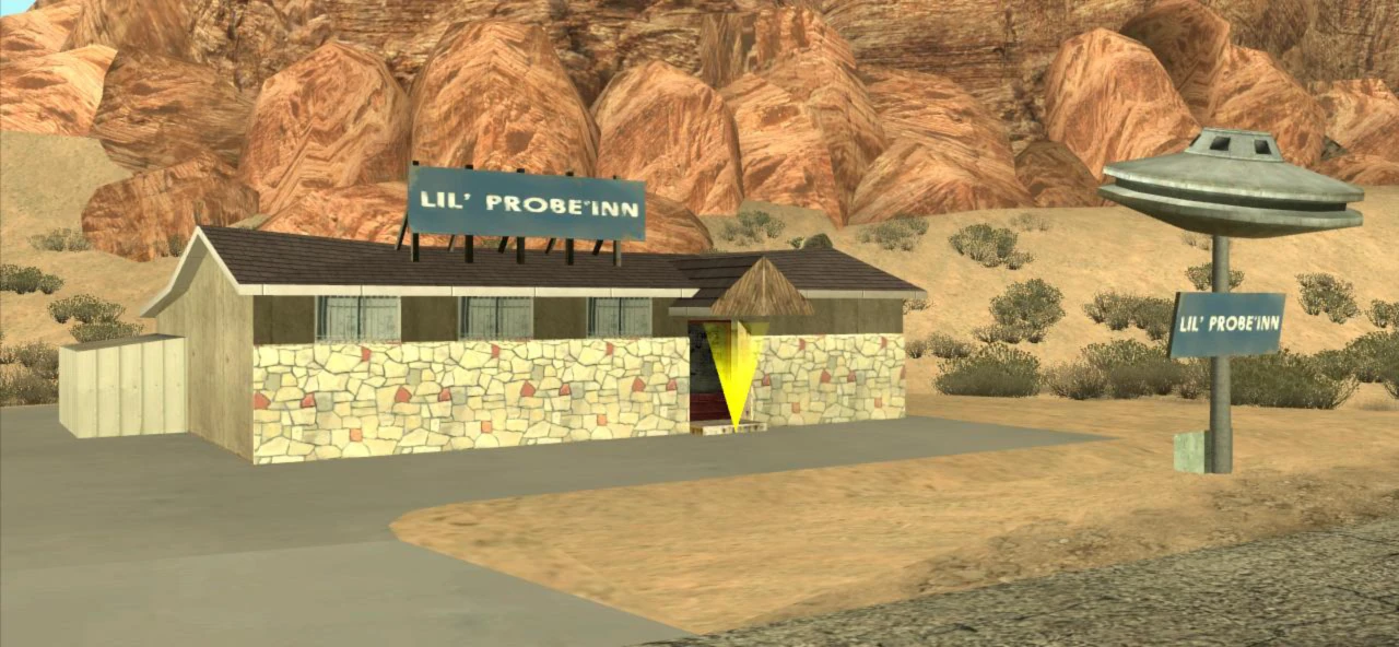
The '''Lil' Probe Inn''', a fictional bar/motel, is located north from Fort Carson. The Lil' Probe Inn is actually a parody of the Little A'le Inn in Rachel; the interior of the Probe Inn matches the interior of the reallife Little A'le Inn. Down the road from the Probe Inn is [[Area 69]]. Its name is a mix of the real-life Little A'le Inn while also referring to "probing", the alleged anal probes used in alien research.
+
The '''Lil' Probe Inn''', a bar/motel, is located north from Fort Carson. The Lil' Probe Inn is actually a parody of the Little A'le Inn in Rachel; the interior of the Probe Inn matches the interior of the real-life Little A'Le'Inn. Down the road from the Lil' Probe Inn is Area 69. Its name is a mix of Little A'Le'Inn, while also referring to "probing", the alleged anal probes used in alien research.
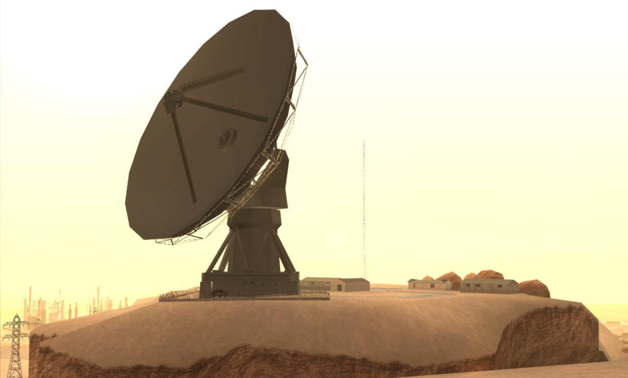
'''The Big Ear''', a large satellite dish located west of Area 69, is claimed by the official ''[[Grand Theft Auto: San Andreas]]'' website to emit radiation that results in birth defects in the local populace, specifically where newborns are born without ears.
'''The Big Ear''', a large satellite dish located west of Area 69, is claimed by the official ''San Andreas'' website to emit radiation that results in birth defects in the local populace, specifically where newborns are born without ears.
'''Las Payasadas''' (Spanish for "clowning off" or "antics") bills itself as the home of "The Big Pecker — the world's largest cock", which in fact is a huge animatronic rooster designed to advertise a store called "[[Pecker's Feed and Seed]]". It is located in northern Bone County. Possibly based on {{WP|Palisade, Nevada|Palisade}}, Nevada.
'''Las Payasadas''' (Spanish for "clowning off" or "antics") bills itself as the home of "The Big Pecker — the world's largest cock", which in fact is a huge animatronic rooster designed to advertise a store called "Pecker's Feed and Seed". It is located in northern Bone County. Possibly based on Palisade, Nevada.
+
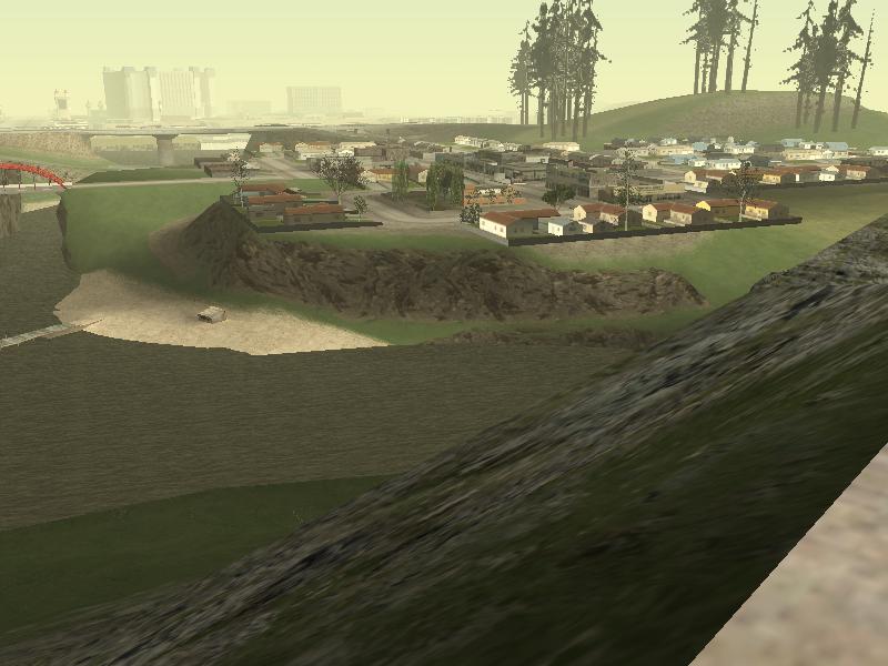
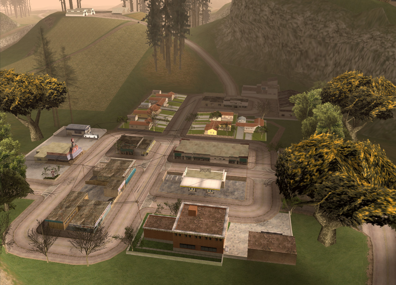
{{Main|East Bone County Town}}
−
+
[[Image:EastBoneCountyTown-GTASA-Overview.png|thumb|150px|right|East Bone County Town]]
+
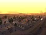
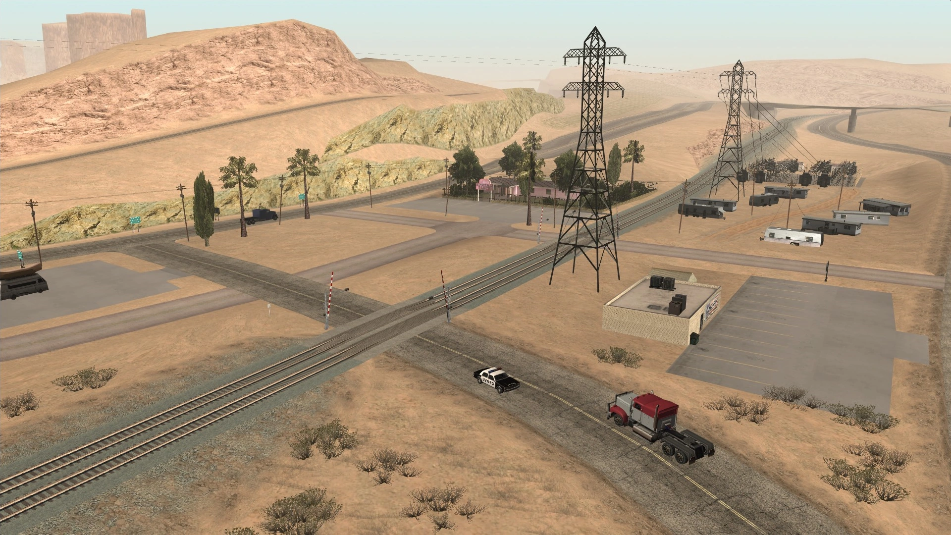
The unnamed East Bone County Town is located directly west of Las Venturas, and is home to [[The Big Spread Ranch]] strip club. It is possibly inspired by various towns and settlements west of Las Vegas, such as Calico Basin, Bonnie Springs, and {{WP|Blue Diamond, Nevada|Blue Diamond}}.
'''Las Brujas''' is another ghost town located in the [[El Castillo del Diablo]] (Translation: The Castle of the Devil) region of Bone County. It is located right off the [[Verdant Meadows Airfield|Verdant Meadows]] airstrip. Its name is Spanish for "The Witches". It is based on {{WP|Bodie, California|Bodie}}, California.
'''Las Brujas''' is another ghost town located in the [[El Castillo del Diablo]] (Translation: The Castle of the Devil) region of Bone County. It is located right off the [[Verdant Meadows]] airstrip. Its name is Spanish for "The Witches". It was based on Bodie, California.
−
==Fault reference==
+
==Fault Line==
−
Inreallife,there is a faultnamed the San Andreas Fault, which runs the whole length of California.Thefaultlinecanbeseen in-game whilediving in the [[San Fierro Bay]].
+
There is [[San Andreas Fault|a fault line]] that goes along the seabed in the [[San Fierro Bay]]. This is a reference to the {{WP|San Andreas Fault}} which runs the whole length of California, which could be an inspiration towards the in-game state's name.
==Trivia==
==Trivia==
+
*[[File:San Andreas County.png|thumb|"San Andreas County"]]According to a radio advertisement in ''[[Grand Theft Auto: Liberty City Stories]]'' and in San Andreas itself, the [[Glory Hole Theme Park]] is located in San Andreas, but it does not appear in the game.
−
*The state is referenced in ''[[Grand Theft Auto IV|GTA IV]]'' in the radio, commercials etc. Places like [[Las Venturas]], [[Vinewood]] and The Los Santos Freeway (which probably is the [[Mulholland Intersection]] or the [[Mulholland Drive]]) are mentioned.
−
*According to a radio advertisement in [[Grand Theft Auto: Liberty City Stories]]andinSan Andreas itself, the[[GloryHoleTheme Park]] is located in San Andreas, but it is not evidenced anywhere in the state.
+
*In ''[[Grand Theft Auto: Vice City Stories|GTA Vice City Stories]]'', sometimes pedestrians will mention San Andreas.
+
*[[Fire Truck]]s display the name "San Andreas County" instead of "State of San Andreas" on its decals.
*The original release on PS2 (and possibly other versions) contains an odd glitch in which aircraft may randomly crash near C.J. as he explores San Andreas, with this actually becoming a potentially deadly risk when exploring some areas (such as downtown Los Santos or San Fierro) on foot.
−
::#Has a state capital
−
::#Has any border states
−
::#Has a state flag or a state seal
−
*San Andreas is the only [[3D Universe]] location to not have a portable rendition.
−
*San Andreas is the only state to be fully rendered in a game in the GTA franchise.
San Andreas is one of the country's most diverse visitor destinations, known for its huge size and incredible variety. Although justly celebrated for its 3 wildly different main cities each with its own style and attractions to offer — Los Santos with its celebrities and sprawling ghettos, San Fierro with its eclectic artist community, and Las Venturas with the glitz and glamour of casinos — it has so much more beyond that; such as mountains, ghost towns, dense forests and hot, dry deserts. Take time to visit the whole state and support local businesses.
”
— GTA San Andreas Manual
The State of San Andreas is a state in Grand Theft Auto: San Andreas. It is primarily based on the states of California and Nevada, with some areas (particularly desert and forest areas) based on parts of Arizona.
San Andreas appears to be comprised entirely of islands, as the state is surrounded by water; however, several maps throughout the state depict the northern regions (Tierra Robada and Bone County) connecting to the mainland (despite this, it is possible to completely circumnavigate the state by boat). The in-game San Andreas is square-shaped and its area is estimated to be 33 square kilometres in size (12.7 square miles), the largest setting in the Grand Theft Auto series up until Grand Theft Auto V's rendition of part of the same state.
There are hints that more areas of San Andreas exist, but are simply not included for gameplay purposes. For example, some maps found in the game connect San Andreas to a mainland. There is also mention of an unnamed state capital.
Official[1] San Andreas Tourist Board high resolution map.
Standard street map of San Andreas.
Mobile version map of San Andreas. The map is slightly different than the original version.
The city bears visible scars of an earthquake, a likely reference to the 1989 Loma Prieta earthquake, three years before the game takes place. However, news on the radio reports on the aftermath of an earthquake early in the game, suggesting that a major earthquake had hit the state recently.
Las Venturas is a city based on Las Vegas, Nevada. It is the second largest city in area and smallest in population in San Andreas, and like its counterpart, Las Venturas is located in a desert region and hosts legalized gambling, sporting casinos such as The Camel's Toe and Caligula's Palace.
The city is also notable for its freeway system. The Julius Thruway is a freeway that circles the whole city. Freeways from both Los Santos and San Fierro intersect with it. Another major road is the Harry Gold Parkway, which runs through the middle of the city and intersects twice with the Julius Thruway and then leads to Los Santos (though it is not called the Harry Gold Parkway once it leaves the city). At one point in the game, the game's protagonist, Carl Johnson, pulls off an Ocean's Eleven-esque heist in Caligula's Casino, subsequently fomenting relationships between Carl Johnson and Salvatore Leone.
Las Venturas is translated from Spanish to English as "The Fortunes."
Counties and Smaller Towns
In addition to the three principal metropolises, San Andreas state is home to several smaller towns and suburbs that are scattered over several counties.
Red County is a rural county located among forests consisting of primarily tall redwood trees and streams. The county is based on the quintessential American countryside and is populated with stereotypical rednecks. It is based on the Central Valley, which is located in the center of California (the center of the map is in Blueberry Acres), the San Fernando Valley, which is just north of Los Angeles, and Orange County, which is south of it.
Palomino Creek, with its infamous wheelchair on the dock.
Palomino Creek is a town located in north east Red County in the state of San Andreas. It is home to a bank, which has suffered from many robberies, a Pizza Stack, and Hanky Panky Point, a popular destination for teenage couples and weird old men. K-Rose radio station mentions a football game between Palomino Creek High School and Blueberry High School in Blueberry (although there is neither a football field nor high school in either town), which might be a reference to the 1986 film The Best of Times, where Taft high school goes against Bakersfield high school in a football game, Bakersfield being a possible inspiration for Palomino Creek.
Palomino Creek is the largest settlement in the state outside of the major cities.
Dillimore is located on the northern outskirts of Los Santos. Although it is a small town, it contains a sheriff's office, a Pay 'n' Spray, a gas station and a diner. It also has a safehouse and houses the large farm estate which contains the Quad.
Blueberry is the biggest rural town in Red County. On the outskirts of town, there is a large farm and brewery. The town itself is home to a liquor store, Ammu-Nation and safehouse. The climate resembles that of San Fierro. It is possible that the buildings on the outskirts of town are a high school, and the fields could possibly be a football field of some sort, which would answer an announcement on K-Rose about a football game between Blueberry & Palomino Creek.
Flint County is an undeveloped rural part of San Andreas. There are no towns and only a couple of farms. There are only a few missions in Flint County throughout the game which mostly involve racing through it.
View of Whetstone featuring the most popular landmark of the area, Mount Chiliad
Whetstone is located in the southwest corner of San Andreas, just south of San Fierro. The county is home to Mount Chiliad, the tallest mountain in the state at a half-mile (800 m) in height.
Bayside is a waterfront town located on the western tip of Tierra Robada, just north across the bay from San Fierro. The sole access point to the town is directly linked to San Fierro via the Gant Bridge. The town contains two notable features: First, its boat school, where Carl can obtain his boating licence; second, the town has a helipad, usually with a helicopter present, useful for traveling. It is a common rest stop for people traveling from San Fierro to Las Venturas.
The presence of the Bayside Marina and its proximity to the Gant Bridge suggests that the town is based on Sausalito, California, and Tiburon, California, before their upscale development, which is almost geographically similar to Bayside, in addition to having one of its access points connected directly to the Golden Gate Bridge.
El Quebrados is home to a sheriff's department, a medical centre (El Quebrados Medical Center), and a safehouse. The town is located east of Bayside. The name El Quebrados, which is an improper mix of singular and plural Spanish, translates roughly to "The Bankrupt," or "The Broken".
Las Barrancas is located within viewing range of the Sherman Dam, and is also located just beside a cliffside ruin. "Las Barrancas" is Spanish for "Canyons". This town is likely based on Moab, Utah.
Aldea Malvada is a ghost town located in Tierra Robada overlooking El Quebrados on the outskirts of town. It literally translates into English as "Evil Village".
Bone County, most likely based on Nye, Esmeralda, and Mineral counties in Nevada, is one of the most important areas of the game, other than the major cities themselves, containing many areas and missions needed for continuation; a large amount of Easter Eggs are also located within it. The county's two most prominent features include a secret military base named "Area 69" (based on Area 51) located at its centre, as well as the Verdant Meadows Airfield, directly north of Area 69. Bone County boasts an oil field (Octane Springs), a quarry, and several unique natural features such as mesas.
The county is bordered in the west by the Sherman Reservoir and Sherman Dam (based on the Hoover Dam) as well as Tierra Robada county. Las Venturas is located to its east, and Red County to its south. The county as a whole is obviously based on rural portions for the American state of Nevada, because it has a similar climate, terrain and topography. A Dinghy raft and a Sea Sparrow can be found docked on both sides of the reservoir. Also, a Skimmer can be found just north of the dam, right at the part where the river (based on the Colorado River) splits.
Area 69 is a restricted military base, modeled after Area 51 and named for the 69 sex position. The base houses various clandestine government projects, including the "Black Project" jetpack. It may possibly house some projects involving UFOs and/or extraterrestrial life, as suggested by the presence of the nearby "Lil' Probe Inn", dialogue on the base's PA system during the "Black Project" mission, and by dialogue on Marvin Trill's in-game radio show.
Much of the base consists of underground research labs, although the player can only enter the labs during the course of one mission, or by finding a way into San Andreas' "Blue Hell", an area under the main terrain mesh, and finding the underground base there. The aboveground structures include a series of control towers, guard posts, and garages for military vehicles. These garages are the first area in the game in which tanks and military helicopters will automatically spawn. The player automatically receives a five-star wanted level for entering, attempting to enter, or flying over the base (at a low altitude); surface-to-air missiles will be fired at the player from the base if he attempts to fly over. The SAM sites which launch the missiles can be destroyed however, and if flying a Hydra aircraft, decoy flares can be deployed to reduce the likelihood of being shot down.
Fort Carson is the largest town in Bone County, and also its county seat, as indicated by the small red building in the main street, having been significantly undeveloped as of 1992. It is based on the real-life towns of Rachel and Carson City, both being in Nevada: Rachel due to it being the closest inhabited settlement to Area 51 and housing the Little A'Le'Inn; Carson City for the appearance of the town itself; the main street, the town hall and the surroundings. North of the town is Area 69, as well as the smaller town of Las Payasadas. It also has a small hospital (Fort Carson Medical Center), a sheriff's office and a safehouse. There is also an Ammu-Nation just outside of town. Fort Carson is also seen in "The Introduction". Ken Rosenberg was in rehab in the town's hospital. The town is located west of Las Venturas. A small cropduster is known to appear next to one of the houses near here and it is flyable.
The Lil' Probe Inn, a bar/motel, is located north from Fort Carson. The Lil' Probe Inn is actually a parody of the Little A'le Inn in Rachel; the interior of the Probe Inn matches the interior of the real-life Little A'Le'Inn. Down the road from the Lil' Probe Inn is Area 69. Its name is a mix of Little A'Le'Inn, while also referring to "probing", the alleged anal probes used in alien research.
The Big Ear, a large satellite dish located west of Area 69, is claimed by the official Grand Theft Auto: San Andreas website to emit radiation that results in birth defects in the local populace, specifically where newborns are born without ears.
Las Payasadas (Spanish for "clowning off" or "antics") bills itself as the home of "The Big Pecker — the world's largest cock", which in fact is a huge animatronic rooster designed to advertise a store called "Pecker's Feed and Seed". It is located in northern Bone County. Possibly based on Palisade, Nevada.
The unnamed East Bone County Town is located directly west of Las Venturas, and is home to The Big Spread Ranch strip club. It is possibly inspired by various towns and settlements west of Las Vegas, such as Calico Basin, Bonnie Springs, and Blue Diamond.
Las Brujas is another ghost town located in the El Castillo del Diablo (Translation: The Castle of the Devil) region of Bone County. It is located right off the Verdant Meadows airstrip. Its name is Spanish for "The Witches". It is based on Bodie, California.
Fault Line
There is a fault line that goes along the seabed in the San Fierro Bay. This is a reference to the San Andreas Fault which runs the whole length of California, which could be an inspiration towards the in-game state's name.
Fire Trucks display the name "San Andreas County" instead of "State of San Andreas" on its decals.
The original release on PS2 (and possibly other versions) contains an odd glitch in which aircraft may randomly crash near C.J. as he explores San Andreas, with this actually becoming a potentially deadly risk when exploring some areas (such as downtown Los Santos or San Fierro) on foot.
![Official[1] San Andreas Tourist Board high resolution map.](/wiki/File:SanAndreasState-GTASA-OfficialRockstarHighResDownload.png "SanAndreasState-GTASA-OfficialRockstarHighResDownload.png (7.39 MB)")
")
")
")
")
")
")


