Moe harthi (talk | contribs) No edit summary |
No edit summary Tag: sourceedit |
||
| (13 intermediate revisions by 8 users not shown) | |||
| Line 1: | Line 1: | ||
| − | [[ |
+ | [[File:ArcodelOeste-GTASA-RockFormation.jpg|thumb|right|300px|right|Arco del Oeste]] |
| + | {{Quote|Arco del Oeste, fantastic sunsets.|[[The Truth]]}} |
||
| ⚫ | |||
| + | '''Arco del Oeste''' (English: Arch of The West) is a rock formation in ''[[Grand Theft Auto: San Andreas]]''. |
||
| + | ==Description== |
||
| ⚫ | |||
| ⚫ | It is located at the northwestern edge of [[Bone County]], [[San Andreas (3D Universe)|San Andreas]], just south of [[Valle Ocultado]] and west of [[Las Brujas]] and [[El Castillo del Diablo]]. It juts into the [[Sherman Reservoir]], providing pristine views of the nearby [[Sherman Dam]] to the south, and features a [[wp:natural arch|natural arch]] and a [[wp:mesa|mesa]], an abandoned mining facility, wooden shacks to the top, and a small dock on the southwestern side. |
||
| + | Below the arc there is a road leading to the top of the hill, which can also be accessed on the opposite side, by another road running from the ghost town of Las Brujas. |
||
| ⚫ | |||
| ⚫ | |||
| ⚫ | |||
| ⚫ | |||
| + | |||
| ⚫ | |||
| ⚫ | |||
* It is also the end-point for [[Black Project|a mission]] for [[The Truth]] later, wherein Carl delivers the [[Jetpack|"Black Project"]] to him, who is on top of the rock formation. |
* It is also the end-point for [[Black Project|a mission]] for [[The Truth]] later, wherein Carl delivers the [[Jetpack|"Black Project"]] to him, who is on top of the rock formation. |
||
| − | * It is featured once again in the [[Las Venturas]] strand of missions, wherein Carl is tasked yet again by The Truth to [[Don Peyote|rescue two drug addled people]], later named as [[Kent Paul]] and [[Maccer]]. |
+ | * It is featured once again in the [[Las Venturas (3D Universe)|Las Venturas]] strand of missions, wherein Carl is tasked yet again by The Truth to [[Don Peyote|rescue two drug addled people]], later named as [[Kent Paul]] and [[Maccer]]. |
| + | ==Miscellaneous== |
||
| − | ==Stationary vehicles== |
||
*[[Kart]] - Inside one of the shacks (upon completion of [[Cut Throat Business]]) |
*[[Kart]] - Inside one of the shacks (upon completion of [[Cut Throat Business]]) |
||
| − | |||
| − | ==Pickups== |
||
*[[Parachute]] - Inside one of the shacks |
*[[Parachute]] - Inside one of the shacks |
||
| − | |||
| − | ==Other== |
||
*One [[Unique Stunt Jumps in GTA San Andreas|unique stunt jump]] |
*One [[Unique Stunt Jumps in GTA San Andreas|unique stunt jump]] |
||
| + | ==Gallery== |
||
| + | <gallery position="center"> |
||
| + | ArcoDelOeste-GTASA-Map.jpg|Map location. |
||
| ⚫ | |||
| + | </gallery> |
||
| + | |||
| + | ==Navigation== |
||
{{GTASA Rural Areas}} |
{{GTASA Rural Areas}} |
||
[[de:Arco del Oeste]] |
[[de:Arco del Oeste]] |
||
[[es:Arco del Oeste]] |
[[es:Arco del Oeste]] |
||
| + | [[pl:Arco del Oeste]] |
||
| + | [[Category:Locations]] |
||
[[Category:Locations in GTA San Andreas]] |
[[Category:Locations in GTA San Andreas]] |
||
| + | [[Category:Places]] |
||
[[Category:Places in Bone County]] |
[[Category:Places in Bone County]] |
||
Revision as of 17:03, 12 March 2016
Arco del Oeste
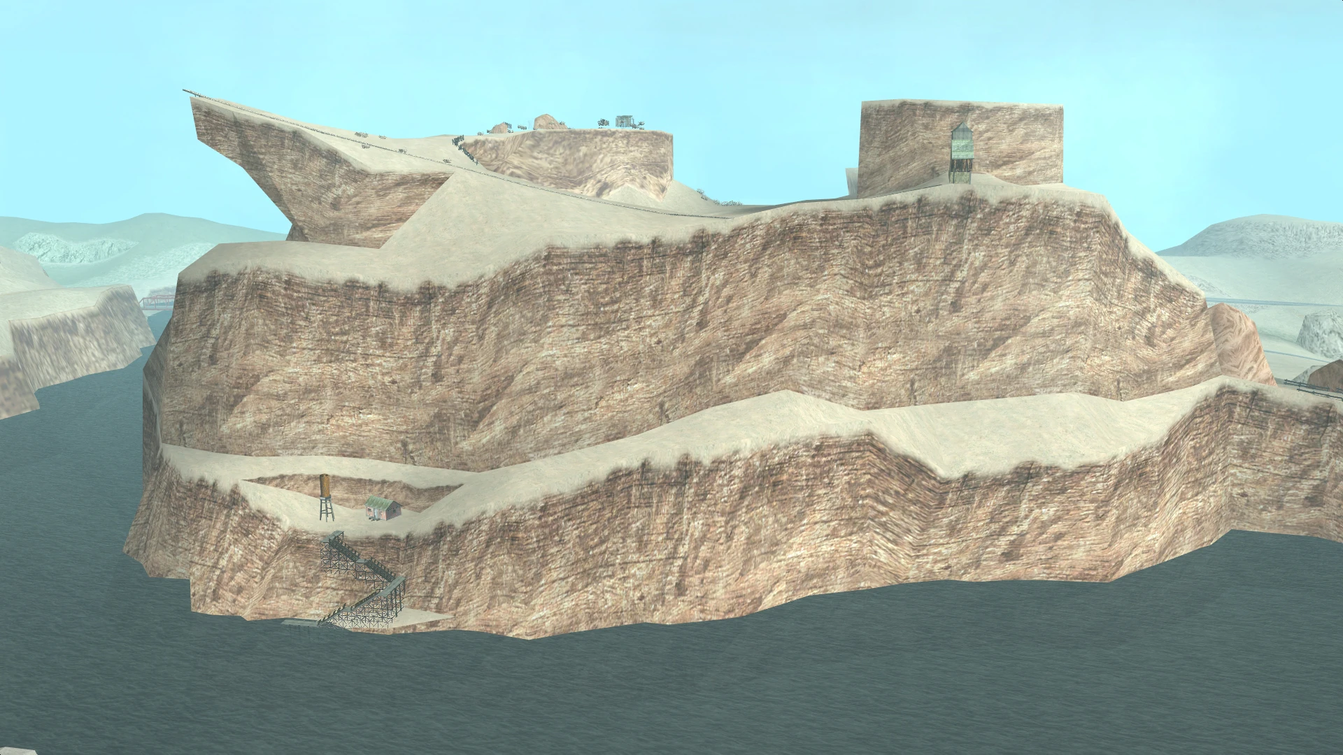
Arco del Oeste (English: Arch of The West) is a rock formation in Grand Theft Auto: San Andreas.
Description
It is located at the northwestern edge of Bone County, San Andreas, just south of Valle Ocultado and west of Las Brujas and El Castillo del Diablo. It juts into the Sherman Reservoir, providing pristine views of the nearby Sherman Dam to the south, and features a natural arch and a mesa, an abandoned mining facility, wooden shacks to the top, and a small dock on the southwestern side.
Below the arc there is a road leading to the top of the hill, which can also be accessed on the opposite side, by another road running from the ghost town of Las Brujas.
Its name translates roughly from Spanish as Arc of the West, apparently taking its name from its natural arch and location towards neighboring Tierra Robada.
Prominent appearances in missions
- Arco del Oeste is the primary location of a mission for Mike Toreno, in which Carl Johnson shoots down numerous helicopters from atop the rock formation using a rocket launcher to keep a cargo helicopter safe.
- It is also the end-point for a mission for The Truth later, wherein Carl delivers the "Black Project" to him, who is on top of the rock formation.
- It is featured once again in the Las Venturas strand of missions, wherein Carl is tasked yet again by The Truth to rescue two drug addled people, later named as Kent Paul and Maccer.
Miscellaneous
- Kart - Inside one of the shacks (upon completion of Cut Throat Business)
- Parachute - Inside one of the shacks
- One unique stunt jump
Gallery
")
")